(*Genuine answers for what people think of when you say ‘lasers!’)
See more with a bird’s eye view
Gary Webster – Heritage Officer, Changing Chalk (supported by NLHF)
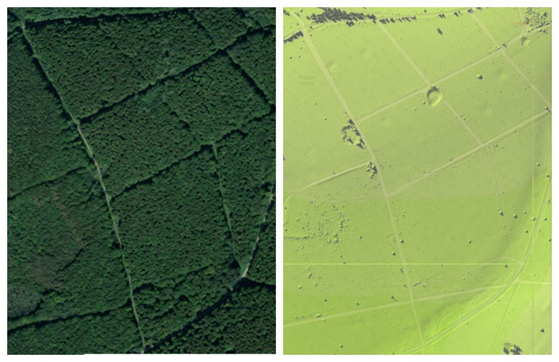
One of the great shifts in modern archaeology, both in identification of features and the recording of them, is in the accessibility of aerial photography. This is both from satellites, and more recently with drones (both recreational and professional). The prevalence of aerial photography has opened the door to other aerial scanning techniques, such as airborne laser scanning, or LiDAR. LiDAR was originally created in the 1960s from technology created to track satellites and military targeting and has been adapted by canny geographers and archaeologists. The technology helps us to see beneath tree canopies and foliage, as the lasers can penetrate through to the ground. This allows for a true representation topography to be created and analysed, enabling the discovery of archaeological features which were no longer visible from the air, or the ground.
Mapping change
Alicia Biles - Historic Environment Advice Assistant Apprentice
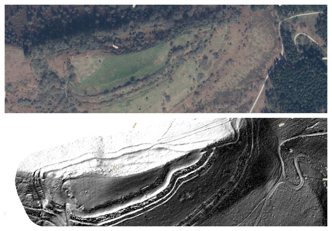
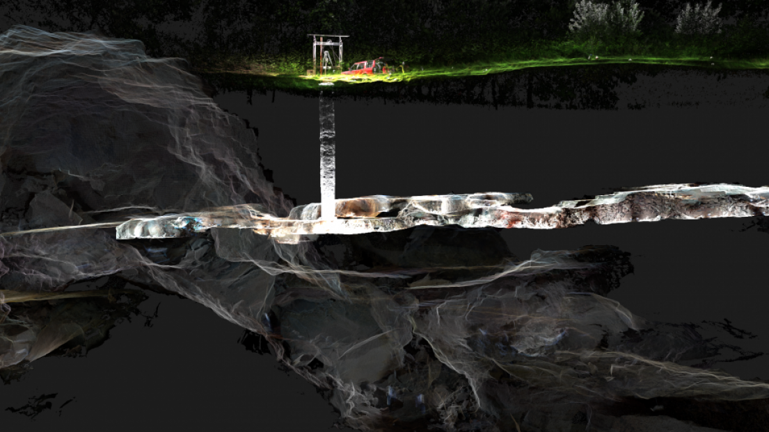
Laser scanning is a technological advancement in survey recording that provides high quality data through a non-intrusive technique. It is used in two main forms in recording archaeology: airborne laser scanning (also commonly known as LiDAR) and terrestrial laser scanning. Both provide high quality and accurate data to record, conserve and monitor archaeology within the Historic Environment. They allow detailed mapping of sites and can be used to identify new features, as well as help monitor and document changes in the landscape and the built heritage – from coastal erosion to loss of architectural components in building. All this data provides additional information which feeds into conservation management decisions, allowing us to better preserve our wonderful cultural landscapes and heritage for future generations.
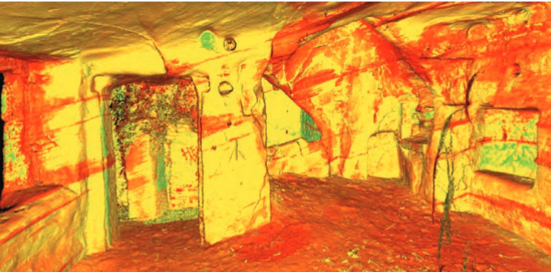
Opening up tricky spaces
A cobalt mine, abandoned in the early 19th century, has recently been discovered and investigated at Alderley Edge in Cheshire revealing a ‘time capsule’ of personal objects and equipment the workers left behind. Laser scanning has enabled a virtual walk through of this incredible space to be created and shared - so now we can all explore it from the comfort of our own armchairs! National Trust archaeologist Jamie Lund says: "We are passionate about giving people the chance to explore our industrial heritage and the Derbyshire Caving Club conducts tours of some of the more accessible mines. But sometimes locations with impractical access mean we need to find other ways to bring the place to life for visitors. Virtual access is a great way anyone can navigate their way around the mine from the comfort of their armchair and imagine themselves in the boots of the men who worked there."
Find out more
- Archaeology at the National Trust
- CBA Festival of Archaeology - It begins this weekend, with hundreds of events to explore
- Cobalt mine at Alderley Edge - Read about the discoveries and take a virtual walk through the passages!
- Beneath the floorboards – see one of last year’s short videos from the Trust archaeology team and look out for more this September
- What's On? - Keep an eye out for more great archaeology events this September
- Blog - Check out our other for more stories of Astounding Inventions
- MOLA - uncovering lost stories of Londoners - Discover what happens after a major dig with our last guest blog from